Guy Hunter-Watts, author of several walking guides to Andalucía, heads off piste for a jaw-dropping gorge adventure in the wilds of Cazorla.
Cazorla Natural Park lies at the eastern edge of the province of Jaén, about a two-hour drive north-east from Granada.
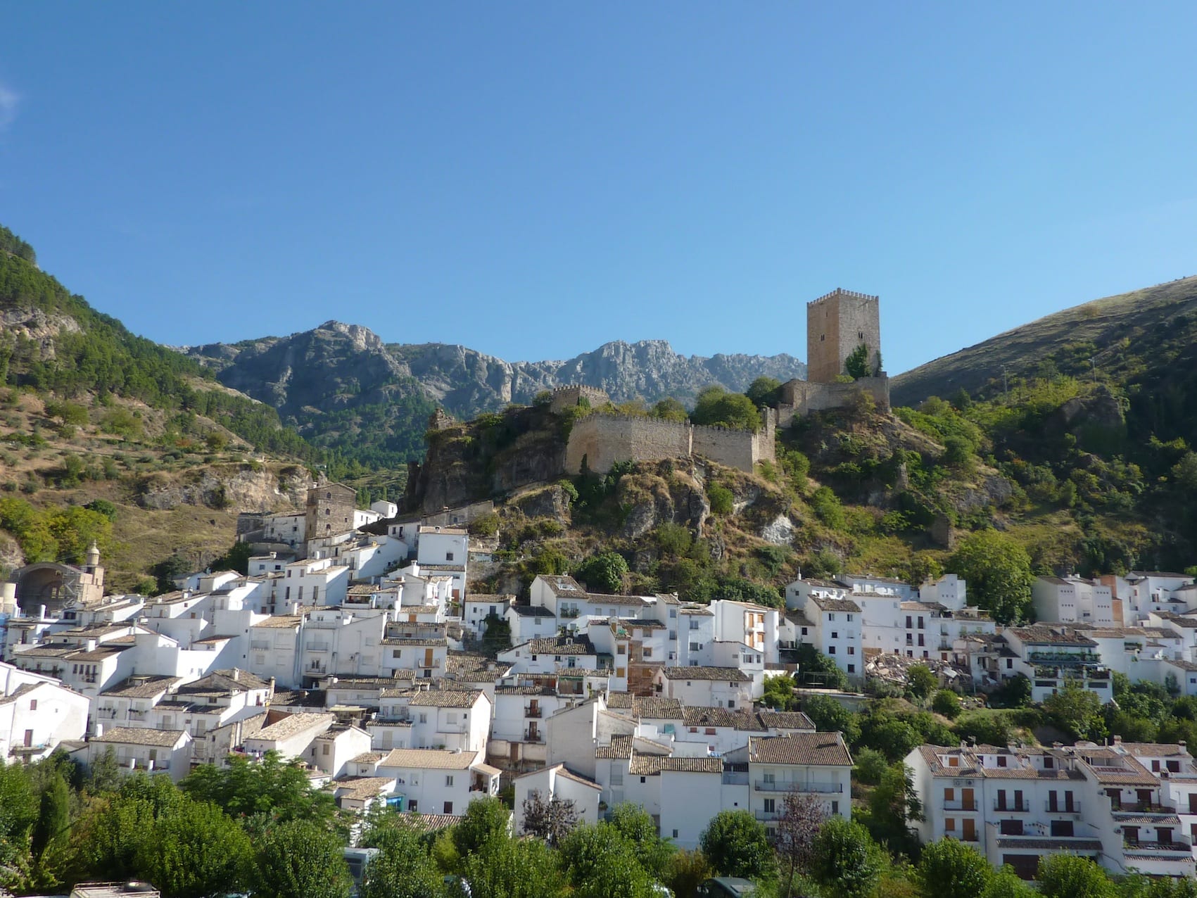
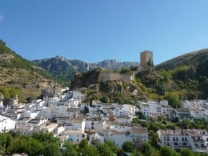
The most common way to approach the park is from the west, via the endless groves of olives that are so much part of Jaen’s landscape. After this unremitting monoculture, it comes as welcome relief to see the jagged crest of the Peña de los Halcones towering above the town of Cazorla (836m), standing sentinel to the park.
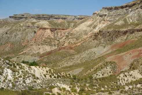
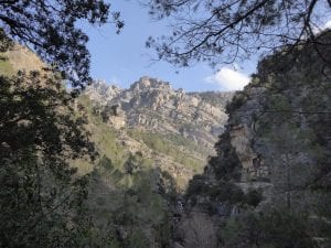
This is Spain’s largest protected area and covers no less than 214,000 hectares of exceptionally diverse terrain. There are vast tracts of pine forest, broad river valleys, deep canyons, spectacular waterfalls and jagged limestone peaks that rise to more than 2000m.
The abundance of game on the thickly forested hillsides made the region popular as a place to hunt in years gone by. But by the 1950s the pickings were becoming so scarce that the area was declared a national hunting reserve.
The original idea was simply to increase the number of moving targets: red deer and wild boar were reintroduced, mouflon brought over from France and fallow deer from the mountains of Segovia. Numbers were monitored, hunting controlled and this soon began to pay big dividends.
The population of Spanish ibex (Caprahispánica) alone rose tenfold in two decades and Cazorla was back on the map as a place to pot game.
The subsequent declaration of the reserve as a Natural Park in 1986, with much tighter controls on hunting, has helped make the region one of the best in Iberia for the observation of wild mammals. Add to this an impressive roll call of birds of prey – including several species of eagle, griffon and Egyptian vultures, goshawks and hobbies – exceptional flora (over 2000 species, with two dozen endemic to the park) – and you begin to get a measure of the biodiversity to be found here.
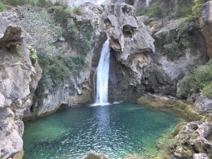
If the best time to walk in Cazorla is from late March to early June and from September to early November, the Borosa gorge walk that follows – with rock pools for swimming and a good deal of shade – is an ideal summer hike, providing you get your boots on early in the day.
Hiking the Río Borosa
The Sierra de Cazorla’s best-known trail takes you along the mesmerisingly beautiful gorge of the Río Borosa.
After following a stretch of forestry track, the gorge narrows down and you continue along a wooden walkway suspended above the river. Later the gorge opens out once again, leading to an amphitheatre of soaring limestone crags. From here, a steep climb leads up to a high reservoir via the course of a mill race that was tunnelled through the mountainside.
Seeing that this is a linear there-and-back hike, you can make it a much shorter trail by just turning back any time you choose.
Bear in mind you’ll have a climb of 630m, should you do the whole walk, and that this is a well-known hike so best tackled on a quieter weekday. Take a torch for the
tunnels and, in the warmer months, pack a swimsuit as you’ll be sorely tempted by the idyllic river pools.
The Nitty Gritty
Start/finish: Trout farm car park just beyond Torre del Vinagre visitor centre
Distance: 21.4km
Ascent/descent: 630m
Grade: Medium/Difficult
Time to allow: At least 7 hours so you can rest and swim
Access: From Cazorla, follow the A319 towards CotoRios. Turn right just before the visitor centre at Torre del Vinagre, then follow signs for Central Eléctrica. There are car parks to the right and left of the road just before you reach the fish farm at the lower end of the Borosa gorge.
The Trail
From the car park, head past the fish farm and a spring, then cross a bridge to reach a sign for Río Borosa. From here, head along the left bank of the river past signs for Zona de Baño (swimming area), then another marking the stretch of the river where angling is permitted. Passing a spring, then a wooden bridge spanning the Borosa, continue along the river’s left bank and then cross a concrete bridge to the opposite side. Soon you cross back to the left bank via a wooden bridge.
At a point where the track bears left and climbs, cut right at a sign for Cerrada de Elías (40min) along a narrow path that hugs the left bank of the river. Soon you cross the river once more and, passing a spring, follow a hanging catwalk above the river through the narrowest stretch of the gorge.

The path meets with the track once again by a signboard depicting the birds that are found in the gorge. Bearing right, continue on up the gorge, crossing back and forth over the river. Ever more spectacular, the gorge begins to open out while, up ahead, the limestone strata of La Cuerda de Las Banderillas and La Peña Plumera look like the layers of some fantastic wedding cake.
As the track bears right, the towering massif of Castellón del Haza de Arriba (1,504m) comes into view, as does the metal pipeline funneling water down to the electricity generating station. Cross a bridge, then follow a fence that runs to the right of the power station and its outbuildings (1hr 55min).
Go past a spring, then cross a narrow wooden bridge and pick up a path at a sign for Laguna de Valdeazores. The path climbs steeply up river’s left bank. Steel yourself for a climb of some 300m, but remember that you can take breaks beside the crystalline rock pools and waterfalls you pass on the way up (it’s also possible to scramble down to them).
The path climbs up to the spectacular amphitheatre of the gorge’s higher reaches where the mountains rise sheerly to a height of 1,500m, dissected by the cleft cut by the waterfall of El Salto de los Oreganos. The path zigzags steeply up over loose scree, then angles right at a sign for Nacimiento de Aguas Negras/Laguna de Valdeazores, before leading into the tunnel cut to bring water to the mill race.

The first tunnel is almost 350m long and the narrow gap between its safety rail and its right side means that a torch is a great help. Exiting the tunnel, continue along the water channel and then enter a second tunnel. About 75m beyond this, you reach a fork; cutting left,you shortly reach the side of the dam of El Embalse de los Órganos, marked on some maps as El Embalse del Borosa or La Laguna de Aguas Negras.
Here the path divides and you bear hard left. Climb away from the water course along the left bank of the reservoir, then follow the course of the Arroyo del Infierno for 300m to the Nacimiento de Aguas Negras (3hr 15min), where the Borosa rises from beneath the rocks.
Later, retrace your footsteps back down the gorge to your point of departure (5hr 50min).
Guy Hunter-Watts is author of Cicerone’s ‘Walking in Andalucía’, ‘Coastal Walks in Andalucía’, ‘The Mountains of Ronda & Grazalema’ and ‘The Andalucían Coast to Coast Walk’. He is at present walking the GR7 across Andalucía.
www.guyhunterwatts.com