

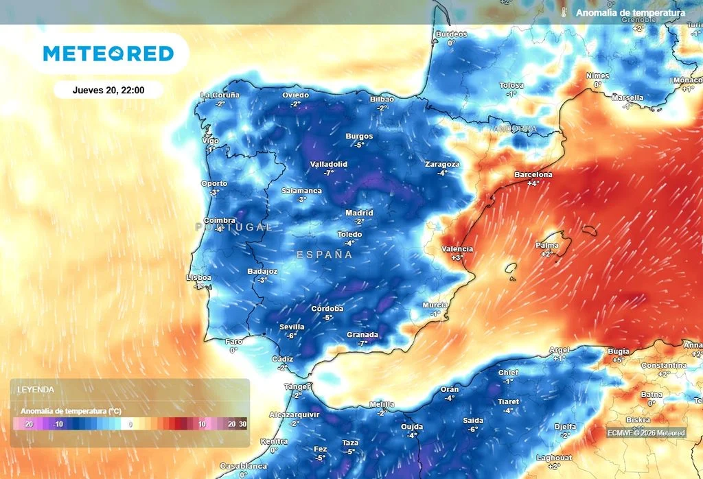
A FRESH mass of cool air has swept towards the Iberian Peninsula, bringing temperatures down by as much as 10C across northern and central Spain.
The cooling trend is being driven by a high-altitude atmospheric depression moving across the country from the northwest.
Northern regions will feel the sharpest contrast, with daytime maximums struggling to pass 23C in Oviedo, Santander and A Coruña.
Further inland, the Guadalquivir valley in Andalucia and the Guadiana basin will see highs drop to around 34C.
The cooler conditions are expected to trigger heavy rain and intense thunderstorms across northern and central Spain heading into the weekend.
But forecasters at weather site Meteored warn that teh relief will not reach the Mediterranean coast and Balearics, which will have to endure another suffocating day of extreme heat.
Red weather warnings remain active across parts of Valencia and Alicante today, where the mercury is set to peak between 42C and 44C.
Warm poniente winds blowing from the west will keep coastal areas baking overnight, pushing daytime highs on Thursday above 35C in Alicante, Valencia, Castellon, Palma and Murcia.
Inland areas of eastern Andalucia, northern Alicante and southern Valencia will see a more moderate drop of between 6C and 8C.
Click here to read more Weather News from The Olive Press.