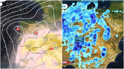
STORM Alice is finally loosening its grip on Spain after a week of battering Mediterranean regions, but forecasters warn there will be precious little respite from the downpours.
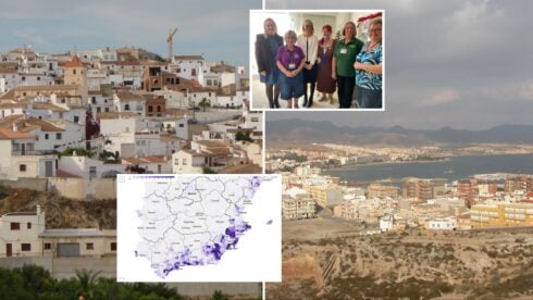
The weather system has spent the past seven days hammering Valencia, Alicante, Catalunya and the Balearic Islands, forcing dozens of municipalities onto rain alerts.
While the storm itself is now subsiding, the State Meteorological Agency (Aemet) has warned that heavy rainfall will persist across these areas into the coming days.
The culprit is a mass of cold air at altitude being pushed towards Spain by an anticyclone sitting over the British Isles.
This cold air, combined with humid easterly winds, will continue to fuel storms across the eastern peninsula and Balearics through the weekend.
The Mediterranean provinces will once again bear the brunt of the weather, with the Valencian Community, Catalunya and particularly the Balearic Islands expecting the heaviest falls.
From Thursday through Saturday, parts of Murcia and some central and southern areas could also see showers.
Forecasters expect the rainfall to be less intense than in previous days, though some strong downpours could hit Menorca and the Pyrenees late in the day or early morning.
READ MORE: Spain’s Carlos Alcaraz could pocket whopping €5m if he wins two ‘exhibition’ matches
The Canary Islands will also see considerable instability until Saturday, bringing heavy rain to parts of the archipelago.
There is some good news on the temperature front. Aemet predicts a pleasant atmosphere with maximum temperatures more typical of September than mid-October, continuing until Saturday October 18.
But as one weather system departs, another is queuing up to take its place. A new Atlantic front is approaching through Galicia and will bring a radical change to weather patterns across the northern half of the country.
After days of relative calm along the Cantabrian coast while the Mediterranean suffered, the tables will turn this weekend. Rain will return to the northern regions while the rest of Spain enjoys more stable conditions.
READ MORE: IMF says Spain’s economic growth in 2025 will be higher than expected- way above eurozone average
The first rainfall from the Atlantic front is expected around midday on Saturday, with cloudy skies developing across the northwest.
Galicia, Asturias and the Cantabrian Mountains will be most affected, with lighter rain also falling in parts of Cantabria.
Sunday October 19 looks set to bring the heaviest precipitation to the Atlantic coast, hitting Galicia, Cantabria and Asturias particularly hard, along with other northwestern regions. Maximum temperatures are forecast to drop across the northern half of the peninsula over the weekend.
Click here to read more Weather News from The Olive Press.