INFAMOUS ‘blood rain’ is set to coat swathes of mainland Spain in gloopy mud this week as a massive plume of Saharan dust sweeps northwards and joins forces with a new wave of Atlantic storms.
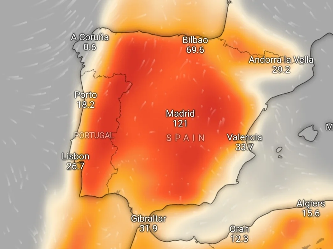
The rare phenomenon is being driven by the arrival of a ‘calima’, a weather event where warm, dry air laden with fine dust and sand particles from the Sahara Desert drifts north, aided by prevailing winds.
The fabled ‘calima’ – sometimes inadequately translated as ‘haze’ – reduces visibility, casting a reddish hue over Spanish skies and severely hampering air quality.
When combined with wet weather, the ‘calima’ can cause dirt-filled showers known colloquially as ‘blood rain’.
These muddy downpours are notorious among expats and locals alike for the messy, hard-to-remove residue they leave on cars, terraces and swimming pools.
The ‘calima’ is being pushed towards the Iberian peninsula by a high-altitude depression around north Africa and the Canary Islands.
The weather system is sucking up vast quantities of sand from Morocco and Mauritania and dragging it north into southern Europe.
However, the sandy skies are set to coincide with the arrival of a DANA storm, named as Regina by Portuguese authorities, which is forecast to bring heavy rainfall to much of Spain from Tuesday.
According to state weather agency Aemet, the storm will make landfall in Portugal before sweeping south to north Africa and the Canary Islands.
From there, the band of rainfall will sweep north through Morocco to the Spanish mainland on Wednesday, starting in Andalucia before drifting east towards the Costa Blanca and Balearic Islands.
As a result, the Canaries are set to be the worst affected area, alongside the south and east of mainland Spain.
The Andalucian provinces of Huelva, Sevilla and Cadiz can expect between 15 and 25mm of rainfall on Tuesday, with more forecast to fall in inland areas.
On Wednesday, around 30mm of rain could drop on areas including Cadiz, Malaga and Sevilla.
Click here to read more Weather News from The Olive Press.