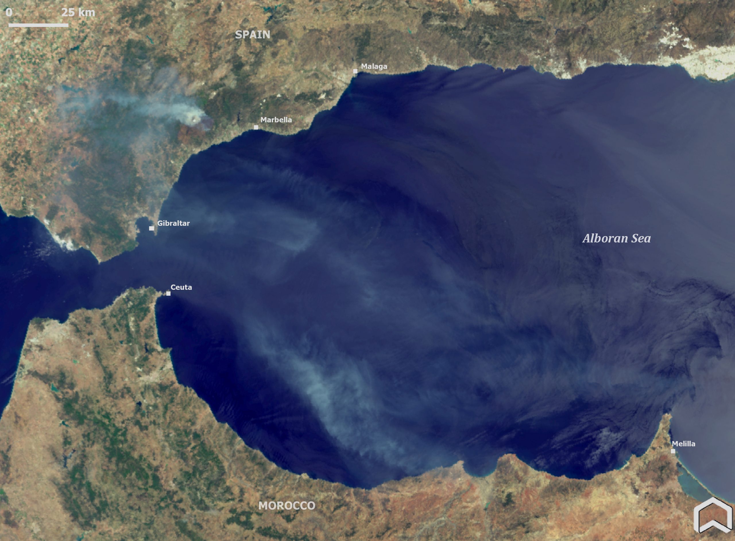
THE wildfire raging in the hills near Benahavis has been photographed from space.
The gigantic smoke plume from the blaze, which broke out in the Sierra Bermeja on Wednesday afternoon, was visible in towns across the Costa del Sol.
The image taken by Copernicus Sentinel 3 satellite shows the smoke stretching out to sea and towards north Africa.
Sentinel 3 was developed by the European Space Agency as part of the Copernicus Programme.
It is tasked with measuring topography, temperature, marine ecosystems, water quality, pollution, and other features for ocean forecasting and environmental monitoring.
On March 31, The European Union Earth Observation Programme – Copernicus – somewhat presciently tweeted a Fire Danger Forecast saying the areas of Murcia, Castilla La Mancha, Valencia and Andalucia were all in ‘extreme danger’ of forest fire.
Authorities said on Friday that the fire had been stabilised and the hundreds of Benahvis residents who had bee evacuated were told they could return home.
The Copernicus project is an EU space initiative that was launched to help understand and mitigate the effects of climate change and ensure civil security.
The European Environment Agency says that global warming is causing forest fires to occur more frequently.
May of this year was the hottest in Spain for almost a century.
READ MORE:
- British holidaymakers forced to sleep in car as wildfire threatened villa on Spain’s Costa del Sol
- Last stand: British expat refuses to leave her home despite risk as wildfire approaches town in hills
- Stay away! Evacuated residents cannot return home for another day as wildfire blazes in the hills above Spain’s Costa…
Click here to read more News from The Olive Press.