ITS 13 mountain systems cover almost half of the land, and almost a quarter of Spain lies above 1000m. The best-known ranges include the Pyrenees, the Picos de Europa, the Sierra de Guadarrama just north of Madrid, and the Sierra Nevada in the south. Within each range, there are thousands of mountain trails, some the domain of serious climbers, but others accessible to hardy day-trippers.
We put on sturdy shoes and multiple layers, and set off to select our pick of the peaks.
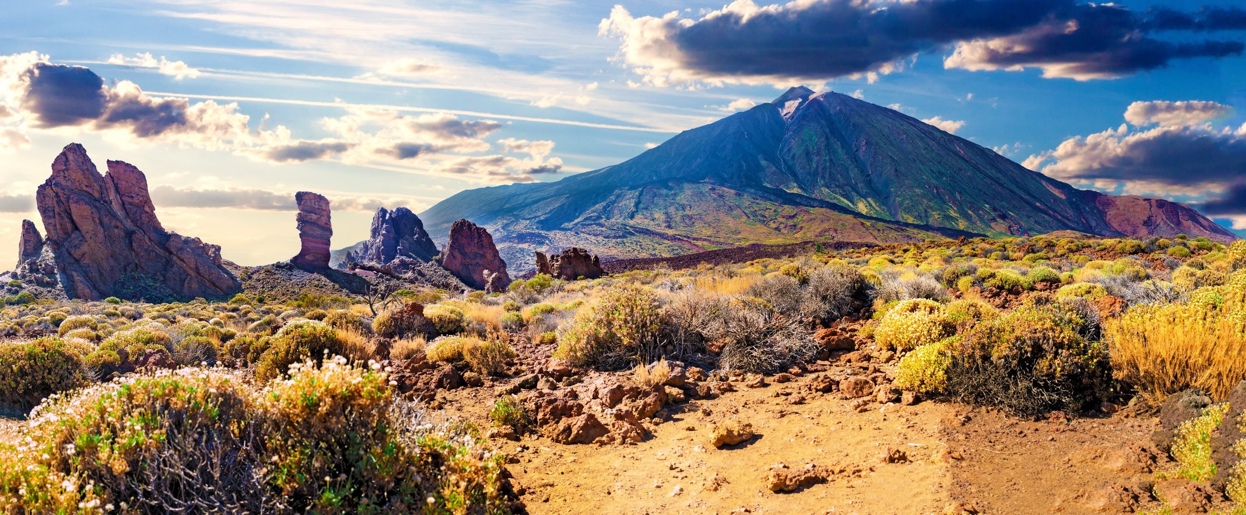
Mount Teide

ACTUALLY a volcano, Teide stretches to an altitude of 3,715 metres above sea level, making it the highest peak in Spain. It’s located on Tenerife, in the Canary Islands, and, in terms of visitor numbers, is Spain’s most popular natural wonder. In fact, Teide National Park, which received over 4 million visitors in 2016, is one of the most visited national parks in Europe.
There are two routes to the summit: one takes around six hours, and the other more than eight. Both are very steep for long stretches, and classed as ‘high difficulty’. Temperatures can frequently drop to below freezing at the top in winter months, and a permit is required to get there. Unsurprisingly, most visitors don’t bother. You can go most of the way in the ‘comfort’ of a cable car, which – over the course of eight harrowing minutes – will take you from the station on the crater floor (2,356m) to plenty high enough (3,555m).
Mulhacen
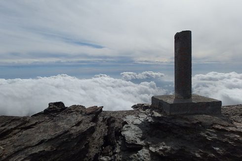
THE highest mountain in mainland Spain, and Western Europe if you exclude the Alps, Mulhacen is located in the Sierra Nevada, and is 3,479 metres. It is named for the penultimate Muslim king of Granada who was allegedly buried on the summit of the mountain in the 15th century. If true, it was an inconvenient spot to choose, but not a prohibitively challenging one.
Three trails to the summit start in the Alpujarras, the most popular being from Capileira, and most people break the hike with an overnight stay at the Refugio Poqueira. Otherwise wait until summer when you can buy a ticket from the Capileira tourist office for a bus which will drop you off at Posiciones del Veleta, just half a day’s walk from the top.
Aneto

AT 3,404 metres, this is not only the highest mountain in Aragon, but in the whole of the Pyrenees. The largest remaining glacier in the Pyrenees lies on its north face, although it is disappearing fast: In 2005, the glacier covered almost 80 hectares, but studies show that half the surface area has been lost in the last 100 years, and there are indications it might be gone altogether by 2050.
Traversing rock and snow and what’s left of the glacier makes this a more technically difficult hike, but it’s suitable for both experienced hikers and beginner mountaineers. It’s usual to spend the night before the push to the summit at Refugio Renclusa, high above the town of La Besurta, in the province of Huesca. Unless you are supremely confident, go with a guide.
Pico Almanzor

CENTRAL Spain’s highest mountain rises up to a respectable 2,591 metres in the Sierra de Gredos, and is largely made of granite. Its name is derived from Al-Mansur, the Arabic for ‘The Victorious’. It’s said that a general during the time of Muslim rule who went by the name Al-Mansur because of his many victories over the Christians, spotted this mountain while riding by on a campaign and was captivated by its beauty. Somehow that filtered down to the map makers.
Easy access from Madrid (two hours away) and Avila (just an hour away) make this a popular destination for urban weekenders. An impressive glacial cirque (scooped out valley) and lake, and viewpoint and summit are all accessible via fairly easy, well-marked trails. Accommodation is available beside the Laguna Grande at the Refugio Elola, and below, in the Valle del Tormes.
Peñalara

PEÑALARA (2,428 metres) is inside the Sierra de Guadarrama National Park which straddles the provinces of Madrid and Segovia. The region is heavily forested with pine and oak, rich with wildlife, and an important habitat for eagles and vultures.
Many routes are available, but the higher altitude circular trail, running through a stunning landscape of lagoons and glacial formations to the peak and back, is the star attraction. While a moderately easy full-day hike during most of the year, wintry conditions can change that. The Peñalara Visitor Centre in Puerto de Cotos, packed with information, should be your first port of call.
Puig Major

PUIG Major is Mallorca’s highest mountain at 1,445 metres, however it is within a military zone and access to the absolute summit is prohibited. The tarmac road that goes close to the top is famous among cyclists who love a fast descent, but if you are intent on climbing by foot to the highest accessible peak on the island, you’ll need to make do with nearby Puig de Massanella (1,364 metres). Both form part of the Sierra de Tranmontana range (known as Serra de Tramuntana in Mallorca) in the north of the island, a UNESCO World Heritage Site. An idyllic circular trail starts and ends at the monastery in Lluc, and should take you around seven hours to complete.
Alcazaba

VISIBLE from Granada, Alcazaba (3,371 metres) is the third highest peak in the Sierra Nevada mountains after neighbouring Mulhacen and Veleta. As for Mulhacen, the preferred route leaves the Refugio de Poqueira above Capileira, before veering off. It may not be the highest, but the hike to Alcazaba is more isolated, steep and challenging, and the views more dramatic as a reward.
Bear in mind that good physical fitness is not enough to guarantee safety. Plan ahead by researching the route, checking the best months to visit and route classifications, and be prepared to ditch your plans if the weather turns nasty. When you do go, dress appropriately, stick to the trails, take plenty of water, and always let someone know your proposed route and estimated return time. Alternatively, go with an accredited guide and enjoy the benefit of their expertise.
READ MORE:
- Looking for an adventure? Here are 12 epic walks to take in Spain
- DOGGONE IT!: New law makes 10km a day walks for dogs compulsory
Click here to read more Olive Press Travel News from The Olive Press.


