A SIZZLING end to May is coming with values more typical of July according to forecasters.
The State Meteorological Agency(Aemet) says blistering highs will be caused by high pressure coming in from the Azores combing with Saharan air.
It is set to produce the first heatwave of the year with temperatures hitting 42C in some parts of Andalucia.
READ MORE:
On Monday, anticyclones will continue over most of Spain with few clouds.
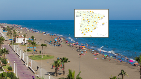
Maximum temperatures will be in the Aragaon, Cantabrian Sea, and Valencian Community regions, with values possibly above 35C in parts of the Guadalquivir Valley in the south.
Aemet spokesperson, Ruben del Campo, said: “We expect from Monday, but especially from Wednesday, midsummer heat.”
Average highs will be between 5C and 10C above average levels, and exceeding 10C on Thursday, with humid nights in the southern and central parts of the mainland, along with the Mediterranean area and Ebro.
The worst areas will be the south-west with up to 42C in the Guadalquivir valley while the Ebro will hit 36C on Thursday and Friday.
The current Azores anticyclone that brought a dramatic change from the weekend after parts of the country including Alicante province suffered heavy downpours.
A mass of warm and dry air from North Africa will appear from Wednesday to boost temperatures still further.
“Rain will be scarce,” according to Del Campo, “beyond some isolated showers in mountain areas.”
“Perhaps at the end of the week there could be an increase in instability, with more clouds and the possibility of storms, especially in the north, and somewhat lower temperatures,” he predicted.
Click here to read more Weather News from The Olive Press.


