A NASTY weather front is set to batter Andalucia and the Strait of Gibraltar as a ‘polar’ air mass sweeps across the peninsula.
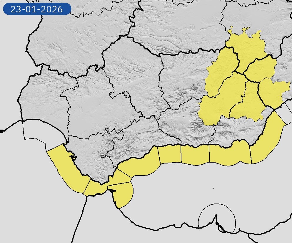
The State Meteorological Agency (AEMET) has issued yellow alerts for strong winds, rough seas and even snow for the region, starting Friday.
It comes after a week of ‘blocking’ weather which is now giving way to a train of Atlantic storms, the most significant of which has been named Storm Ingrid.
While the north of Spain is facing the brunt of the impact—with red alerts active in Galicia—the south will not escape the deluge.
Forecasters warn that the area surrounding the Strait of Gibraltar will see ‘significant’ rainfall accumulating from Thursday afternoon as the front moves across the western half of the country.
By Friday, the situation will intensify as a cold polar air mass is dragged down from the north.
AEMET Andalucia has activated yellow warnings for coastal risks and high winds for Friday, extending to Ceuta which faces a similar battering.
Snow warnings have also been issued for the region, likely restricted to higher altitudes as the snow line plummets across the country.
Nationally, the white stuff could fall as low as 500 metres in the northwest, threatening travel chaos on the roads for anyone heading north for the weekend.
The storm is expected to peak on Friday and Saturday before the polar mass begins to retreat on Sunday, allowing temperatures to recover slightly.
Drivers are advised to exercise extreme caution and check road conditions before setting out, particularly if crossing mountain passes.
Click here to read more Andalucia News from The Olive Press.