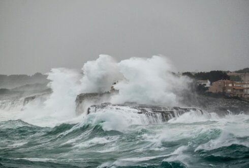
ANDALUCIA is facing a week of stormy weather and relentless rains, intense winds and rough seas.
The entire region is under yellow alerts as of 8am today which are set to continue right in to tomorrow.
The instability will be felt with particular intensity in the west and south of the region, including the Costa del Sol, according to state weather agency Aemet.
Especially strong orange alerts will be in place for intense rainfall in Grazalema tomorrow, as well as the Granada and Almeria coasts.
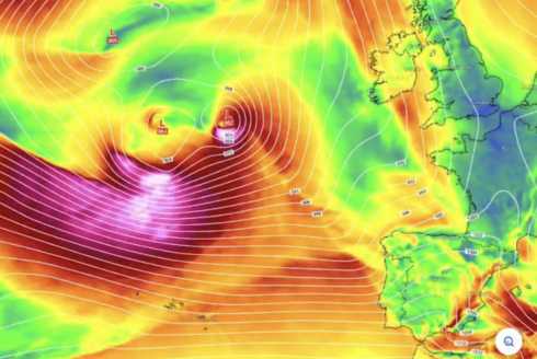
Continuous Atlantic storms are expected to leave ‘very significant’ rainfall accumulations.
Aemet spokesman Ruben del Campo warned of the risk of floods and rising river levels.
Precipitation will be especially abundant in the mountain ranges of Cadiz and Malaga.
Effects of the first storm, named Joseph, are already being felt this Tuesday.
Gusts could exceed 70km/h while rough seas batter the coast.
Marbella has closed all public parks as a preventative measure following a yellow alert from Aemet.
Temperatures remain unseasonably high initially, placing the snow line above 2,000 metres.
This favours snow melt which could aggravate flooding in rivers and streams.
The new front, arriving today, is accompanied by strong but humid winds.
Rain will be more frequent and locally strong in the interior and mountains, with possible hail.
Temperatures are also set to drop, lowering the snow line to between 800 and 1,200 metres.
The situation will barely change on Wednesday with rain continuing, especially in mountainous areas.
However, the snow line will rise again, causing rain to fall on existing snow and increasing the flood risk.
New Atlantic fronts are expected later in the week, keeping the wet weather in place for the foreseeable future.
Click here to read more Andalucia News from The Olive Press.