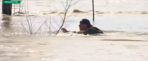
MALAGA is facing yet another battering this weekend as the seventh named storm of the year prepares to sweep across the province.
Just as the floodwaters from Storm Leonardo begin to recede, state weather agency Aemet has warned that Storm Marta is close behind.
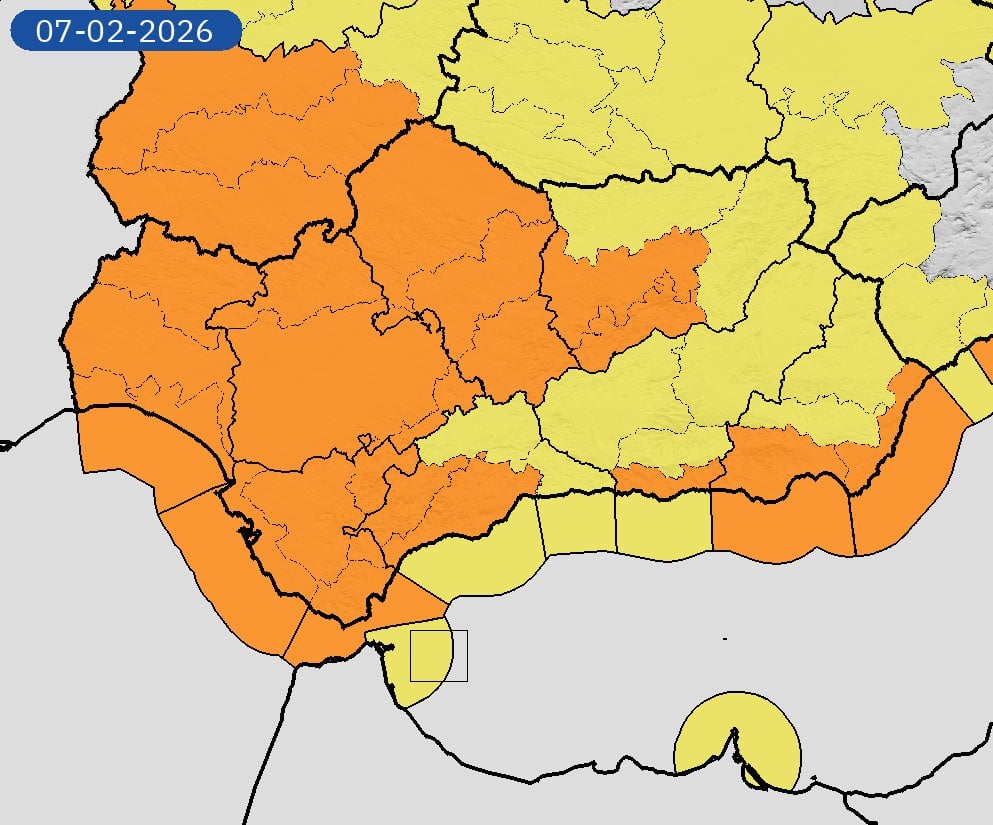
The new front has been classified as ‘high impact’ and is expected to hit on Saturday, February 7, with orange alerts now in place for the Costa del Sol, Costa Tropical – as well as all of Cadiz and Sevilla provinces plus the Almeria coast.
It brings with it a fresh band of heavy rain that will target the exact areas left most vulnerable by this week’s deluge.

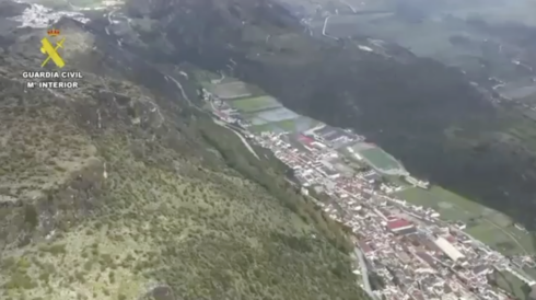
Forecasters predict the Serrania de Ronda, the Guadiaro basin and the western Costa del Sol (between Marbella and Manilva) will bear the brunt of the downpours.
Up to 60mm could fall in just 12 hours in the Ronda area, which is now on on an orange alert.
While this is less severe than the historic totals seen earlier this week, the ground is already saturated, raising fears of renewed flooding in the Guadiaro and Genal valleys.
Strong winds will accompany the rain, with gusts of up to 70km/h forecast for the Malaga coastline and the Guadalhorce Valley.
The sea will also be rough, with Aemet predicting Force 7 westerly winds and waves reaching heights of two to three metres.
Meteorologist Jose Luis Escudero explained that the storm is being driven by a ‘secondary low-pressure system’ forming off the coast of Portugal.
It marks the continuation of a relentless ‘train of storms’ that has pummelled the province since the start of the year.
Marta is the seventh named storm to hit Spain in 2026, following Goretti, Harry, Ingrid, Joseph, Kristin and Leonardo.
Mario Picazo, a meteorologist for Eltiempo.es, confirmed that Marta will leave ‘significant amounts of water and snow’ across the southwest of the peninsula.
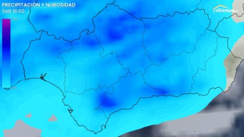
The wet weather is expected to last for 24 hours throughout Saturday before the system moves on.
Click here to read more Andalucia News from The Olive Press.