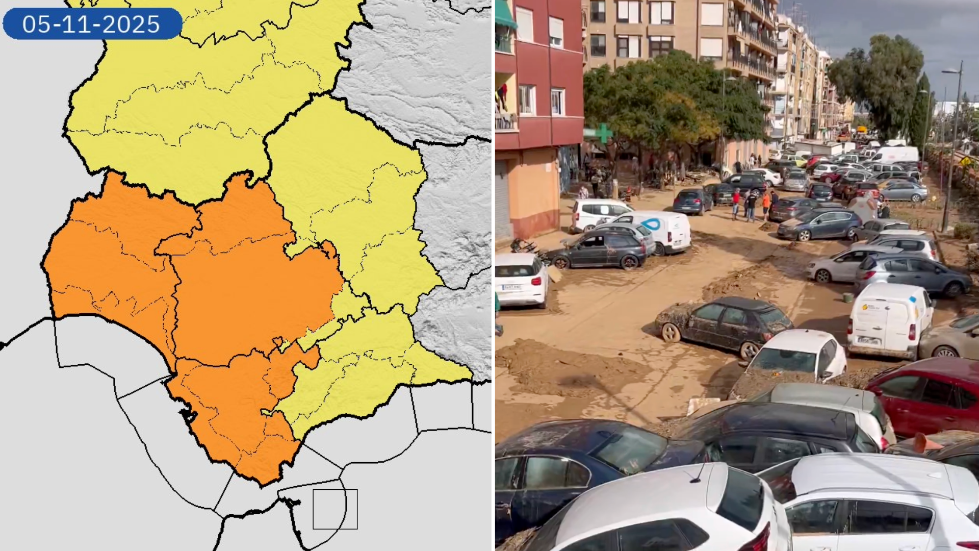
ANDALUCIA is facing another night of heavy rain, high winds and thunder as ex-hurricane Melissa sweeps in from the Atlantic, triggering orange and yellow weather alerts across the region.
The Spanish weather agency AEMET has warned that the storm’s remnants will unleash torrential downpours from Tuesday evening, with Sevilla province braced for another soaking just days after flash flooding swamped parts of the city.
Orange alerts are now in force along the Costa de la Luz and Campo de Gibraltar, where up to 30mm could fall in a single hour and southerly winds may gust to force eight at sea.
The orange warnings stretch from Huelva to Tarifa, covering almost the entire Costa de la Luz.
Further east, Malaga and the Costa del Sol have been placed under yellow alerts from 4pm to midnight on Wednesday (November 5) for rain, wind and thunderstorms, with gusts of up to 70 km/h and the risk of locally intense storms in the Guadalhorce valley.
Civil Protection in Antequera has urged residents to stay alert and follow official updates, warning of possible lightning strikes and brief flash flooding.
The AEMET says the front marks the arrival of a more winter-like pattern, as the dying Atlantic hurricane merges with a deep low west of Galicia to drive humid air across the peninsula.
Waves of up to eight metres are expected off the Cadiz and Huelva coasts, while the north-west continues to be battered by winds topping 110 km/h in mountain zones.
Click here to read more Weather News from The Olive Press.