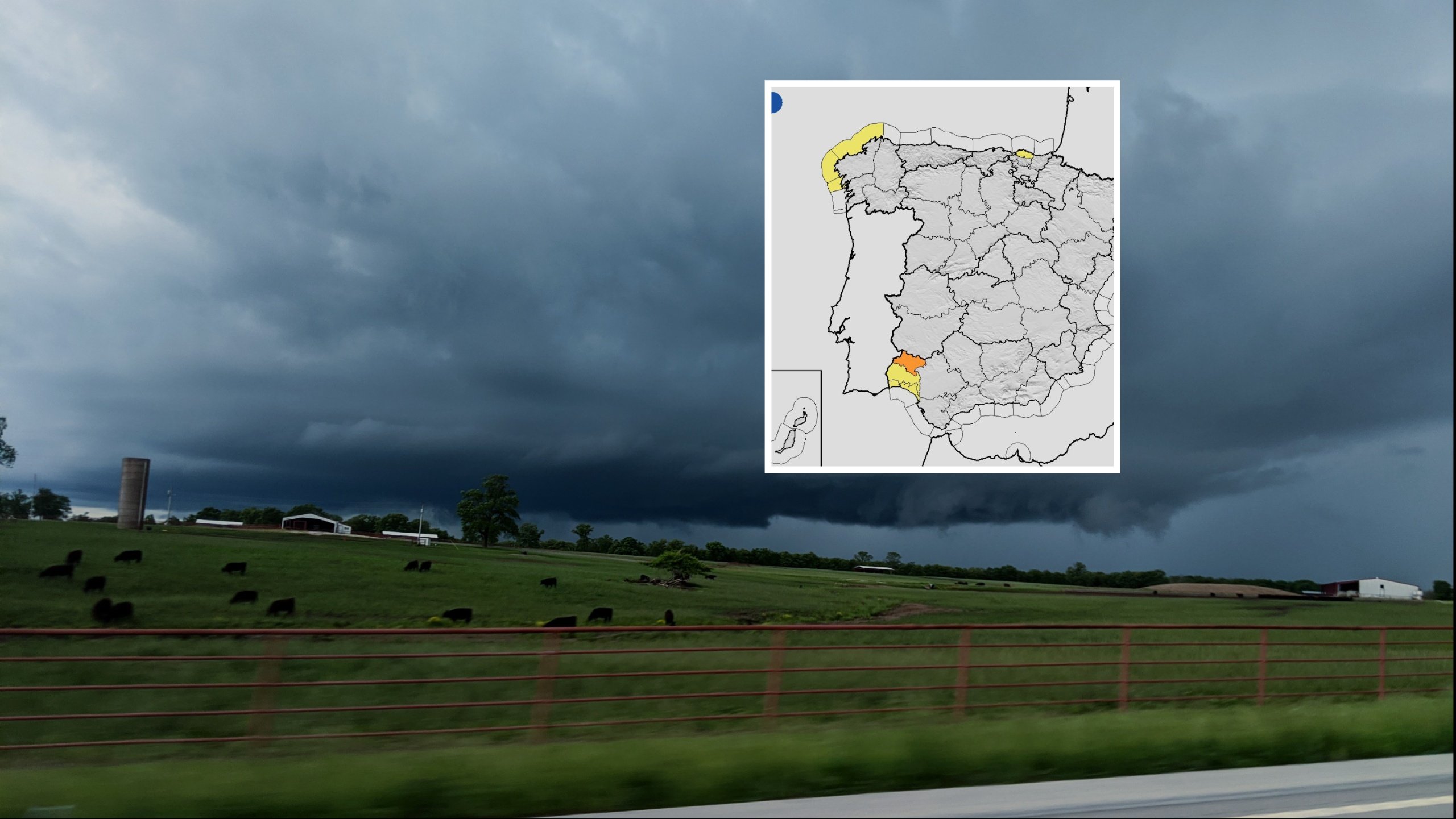
A NEW storm system is heading for Andalucia this week with Aemet issuing an orange alert for heavy rain in Huelva as a fresh Atlantic low moves in from Friday.
The warning comes as a frontal system crossed the region on Wednesday, bringing rain to the western half before moving eastwards across central Andalucia.
The new system is expected to generate locally intense rainfall from Friday through the start of next week as a cut-off low forms over the peninsula.
Aemet says the worst of the rain will fall in western and central Andalucia, placing areas such as Huelva and parts of Sevilla under renewed threat after recent storms.
The orange alert for Huelva will activate this afternoon around Aracena, with the DGT urging drivers to take extra care and check road conditions before travelling.
Forecast models show significant rainfall in Huelva between 13.00 and 19.00 today, with further accumulations likely once the new system arrives on Friday.
READ MORE: Spaniards side with Britain’s FT in its assault on Spain’s ‘I win, you lose’ tax agency
Aemet’s outlook for the next few days suggests the heaviest rain will remain to the west and centre of the region, with the far east of Andalucia seeing little impact.
For the Costa del Sol, today’s front is expected to weaken as it moves east, while the weekend storm should bring cloud and scattered showers but not the intense accumulations forecast for Huelva and inland Sevilla.
Temperatures across Andalucia will drop as the front passes, with a more noticeable decline expected in inland areas.
National warnings have also been issued for coastal conditions in Galicia and rain in Cantabria, as the wider system affects much of Spain.
The storm is expected to linger into the early days of next week before conditions stabilise.
Click here to read more Andalucia News from The Olive Press.