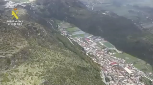
OFFICIAL flood maps have revealed the neighbourhoods most at risk of catastrophe today as Storm Leonardo dumps hundreds of litres of rain onto already-saturated ground.
With the Junta warning that ‘any zone flooded in the last 50 years’ is liable to flood again, experts are pointing to the ‘black spots’ identified by the Ministry for Ecological Transition (MITECO).
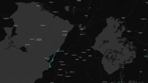
The high-resolution charts highlight specific ‘traps’ in the most popular expat coastal towns where topography creates a perfect storm for inundation.
Fuengirola: The ‘Great Lake’
The most visually alarming chart focuses on Fuengirola, where the river mouth forms a massive potential flood zone.
Maps show a solid block of high risk engulfing the area around the Sohail Castle and the Miramar shopping centre district.

Known locally as the ‘Great Lake’ scenario, this threatens to turn the entire lower basin of the town into an extension of the sea.
Further east in the town, Los Boliches is identified as a critical trap.
A distinct flood channel cuts through the densely populated neighbourhood, following the path of the Rio Pajares.
This puts hundreds of townhouses and apartments in the streets behind the Paseo Maritimo directly in the firing line.
Inland, the risk extends upstream into Campo Mijas and Cerros del Aguila, potentially cutting off access roads to these popular urbanisations.
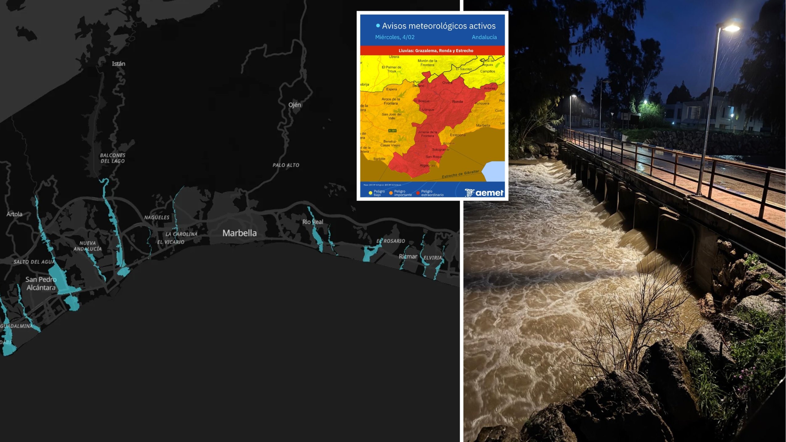
Marbella: The danger zones
In Marbella, the threat is concentrated in the west and the east.
San Pedro de Alcantara is flanked by two major arteries of danger – the Rio Guadaiza and Rio Guadalmina.

Charts show wide floodplains cutting through the golf courses and residential areas down to the sea, threatening properties built on the banks.
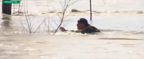
The Rio Verde, which flows into the sea near the Golden Mile, is marked as a significant flashpoint.
This was the site of a ‘high-risk’ rescue this morning where firefighters had to pull a driver from a vehicle swept away by rising waters.
To the east of the Marbella arch, the map reveals dozens of smaller, narrow flood channels cutting through Rio Real, El Rosario and Elviria.
These ‘combs’ pose a high risk of flash flooding in beachside urbanisations where streams can turn into raging torrents in minutes.
READ MORE: Andalucia schools will shut as storm set to cause continued weather chaos and heavy downpours
Axarquia: The ‘Triangle’
On the eastern Costa del Sol, the Rio Velez forms a massive blue triangle at its mouth in Torre del Mar.
This effectively severs the coastal town from the inland city of Velez-Malaga, with the flood zone extending kilometres inland past Benamocarra.
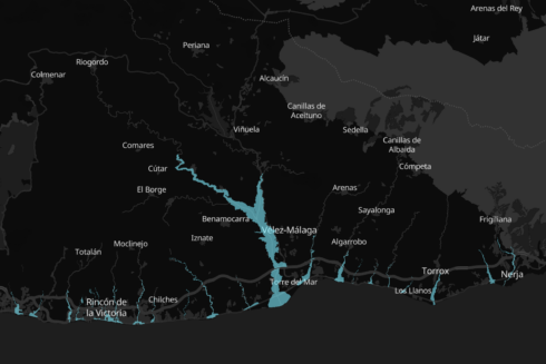
In Rincon de la Victoria, multiple small stream overflows are marked along the coast, threatening the N-340 road.
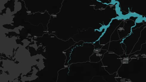
Inland: The ‘Web’ and the Valley
Inland Malaga faces a different kind of threat.
The maps for Antequera show a sprawling ‘web’ of floodwater surrounding Bobadilla Estacion, a critical railway hub.
Unlike the coast, the water here does not follow a single channel but spreads out across the flat plains, creating a vast lake effect.
In the Guadalhorce Valley, a traditional black spot for flooding, the Rio Pereilas snakes around Coin, cutting through the El Rodeo area.
Further west in the Serrania de Ronda, the risk is confined to the sharp, deep valley of the Rio Guadiaro.
The river corridor threatens to isolate the villages of Jimera de Libar and Benaojan.
Just north of Ronda, the hamlet of Llano de la Cruz sits in a critical pinch point.
The Rio Guadalcobacín frequently bursts its banks here, cutting off the rural hotels and bridges in the valley bottom.
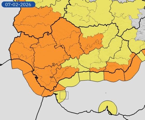
Authorities have based these ‘extreme risk’ warnings on models with a 500-year return period, meaning they account for the most severe weather events statistically possible.
But with the ground already soaked from weeks of rain, officials warn that the soil has lost its capacity to absorb water, turning even moderate rainfall into dangerous runoff.
Click here to read more Andalucia News from The Olive Press.