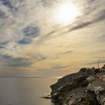
THIS figure of eight walk takes you past two of the best stretches of sand on the Costa Tropical, Cantarrijan and the mesmerizingly beautiful beach of El Canuelo.
Both beaches restrict vehicle access in summer meaning that even then you can stake a claim on the sand.
And the snorkelling and diving are among the best in Andalucia.
The walk leads past two 16th century watch towers which once formed part of a line of communications that stretched all the way along Spain’s southern seaboard.
And a stunning middle section of the trail takes you along the spine of the Caleta ridge.
This is walking at its dramatic best but not for anyone who suffers from vertigo.
The path at this stage is less clear but way-marking and cairns make things much easier and the views from the Caleta’s summit are breathtaking.
Be prepared for two stretches of road walking and three steep ascents.
But don’t let these short sections of tarmac put you off: there’s precious little traffic on the old coastal road and the views are stunning.
If you’re walking the route in July or August you could avoid the steep climb back up to the N340 from Cantarrijan beach by hopping into one of the minibuses which run a regular shuttle throughout the day.
Getting to the beginning of the walk
From the A7-E15 motorway take the exit for La Herredura/Almunecar.
Reaching a roundabout at the bottom of the hill turn right on the N340A towards Maro then turn right again at km 305 for Cerro Gordo.
Continue along the old coastal road to a sign Mirador de Cerro Gordo.
There’s room to park on the left.
The walk
The walk begins next to the Mirador de Cerro Gordo.
From here follow a path signposted Sendero past the Mirador restaurant.
Reaching a junction stick to the higher path and after 250m you reach the Torre Vigia.
After visiting the tower return to the start point of the walk then turn left (20 mins) and follow a tarmac road past Casa Lupo y Lupita to a sign Playa Naturista Cantarrijan.
Here cut hard left past a ‘No Entry’ sign.
After cutting beneath a dilapidated building the road angles right then passes a barrier and a number of houses before reaching the Cantarrijan beach. (50 mins)
Turn right and head along to the far end the beach then cut right at a sign Prohibido Aparcar along a track which passes left of a car park.
After 100m, angle left away from the track and continue up a (dry) streambed following G.R. way-marking.
Be careful! Following the barranco north for 350m you’ll see two large boulders flanking a path that cuts up to the road.
Ignoring this path angle hard left and leave the streambed via a path which loops up then runs towards the sea.
At the top of a bluff you reach a junction (*) where a path cuts up to the right.
Take the left option, maintaining your course.
Soon a watch tower comes into view: to your right is the towering southern face of Cerro Caleta.
Blue dots and G.R. flashes mark your way and lead to a fork.
Here cut left for 200m to the Torre de Caleta. (1 hr 30 mins)
After visiting the tower retrace your footsteps back to the fork.
Turning left after 25m you reach another junction.
To shorten the walk, which means not visiting El Canuelo, angle right up a steep path which soon passes left of ruin then climbs directly north past a second ruin before merging with a track that leads you to the access track of El Canuelo beach.
Here turn right then pick up these notes at the point where you pass the shrine to San Judas Tadeo.
If you wish to visit the beautiful beach of El Canuelo bear left.
The path runs close to the edge of a barranco, descends steeply through pines, before cutting right at a small cairn and angling down towards a ruin on a bluff above a tiny cove.
The path is less distinct but G.R. way-marking guides you down. 40m before reaching the ruin angle right across the hillside along a narrow path on a northerly course.
Cutting through thick vegetation the path drops down to the beach of El Canuelo. (1 hr 50 mins)
Head northwest past Chiringuito Las Piedras then cut right beyond a bus stop (they only run in summer) and head on up a track.
After climbing steeply the track angles right past two water deposits then bears once more left.
At the top of the rise, looking right, you’ll see a shrine.
Cut right to the shrine dedicated to San Judas Tadeo then angle right and pick up a narrow path which climbs steeply through the scrub.
Reaching a carob tree, loop left then right then head on parallel to the Caleta ridge.
Following cairns and blue dots you pass a saddle before reaching the highest point on the ridge (239m). (2 hrs 45 mins)
Head down on the same course, just left of the ridge (there are steep drops on its sea-facing side) following cairns and blue dots.
After cutting through thicker undergrowth you return to the junction at the point marked (*) earlier in these notes. (3 hrs 10 mins)
Turn left and retrace the path back down into the streambed.
Angling left between two boulders you reach the access track to Cantarrijan. Follow this steep track up to the N340 and a barrier and car park.
Turn right then after 200m branch right again at a sign Cerro Gordo. Follow this quiet road back to the start point of the walk. (4 hrs 5 mins)
The walk is taken from Guy’s latest hiking guide Coastal Walks in Andalucia which contains a selection of 50 stunning walks close to southern Spain’s Atlantic and Mediterranean coastlines.


