AUTHORITIES have issued two maximum red weather warnings and a series of orange alerts across Andalucia as a ‘monster’ weather system prepares to make landfall on Wednesday.
Experts are warning that Storm Leonardo, officially named by the Portuguese meteorological agency, is being supercharged by an ‘extraordinary’ atmospheric river.
Meteorologists describe the phenomenon as a ‘river in the sky’ – a narrow, concentrated band of water vapour extending from the Caribbean all the way to the Iberian Peninsula.
Weather agency Meteored has warned the event is ‘off the charts’, with data showing moisture levels doubling the values typically considered ‘extreme’ on the Extreme Forecast Index (EFI).
READ MORE: Sewage storm: Expats outraged as heavy rain forces human waste onto their street
The result will be like ‘gasoline’ for the incoming storm, bringing torrential rain to soil that is already saturated from weeks of relentless downpours.
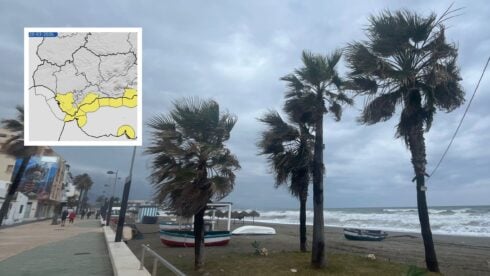
Spain’s state weather agency AEMET has activated a red alert for the Grazalema area in Cadiz and the Serrania de Ronda in Malaga for Wednesday.
The worst of the weather is set to arrive in two distinct phases, intensifying rapidly overnight.
The heavy rains and strong winds will begin to sweep in from Tuesday afternoon and evening, but the most severe conditions will hit from 00:00 on Wednesday (midnight tonight), when the official red alerts come into force, lasting throughout the day and into Thursday.
READ MORE: More heavy rain on the way as new Atlantic storms roll in across Spain: These are the affected areas
Forecasters predict accumulated rainfall could exceed 200mm in just 24 hours in these zones, creating an ‘extreme danger’ of flash flooding.
The situation is particularly critical because reservoirs are already full and rivers are swollen.
Emergency services 112 Andalucia have already managed over 750 incidents related to wind and rain on Monday alone.
Winds are expected to reach ferocious speeds of up to 100km/h, particularly around the Strait of Gibraltar and the Cadiz coastline.
In the Sierra Nevada, the situation is described as ‘complex’.
While over two metres of snow could fall at high altitudes, a massive thaw is expected at lower levels, adding millions of litres of meltwater to already raging rivers.
River levels across the region are being monitored closely, with high to extreme risks of overflowing declared for the Guadalete and Guadalquivir basins.
The Junta has convened its emergency committee (CECOPI) to coordinate the response.
Residents are being urged to exercise maximum caution.
Official advice states that people should avoid all unnecessary travel, never cross flooded roads or bridges, and stay away from basements and low-lying areas.
If water enters the home, the advice is to seek the highest point immediately and call 112.
The intense rainfall is expected to last until at least Thursday, with another weather front potentially arriving by the weekend.
Click here to read more Andalucia News from The Olive Press.