A RARE weather pattern known is set to drive temperatures up worldwide and likely make next year the hottest on record, scientists have warned.
Current models, including research from the European Union’s Copernicus Climate Change Service, say there is now more than an 80 per cent chance of a ‘very strong’ El Niño forming this year.
The weather phenomenon could drive a spike in global temperatures, intensifying extreme weather events across the world.
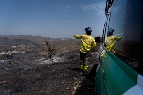
That could mean a harsher than normal winter before a record-breaking summer of heat next year, with the mercury in Spain potentially topping recent scorching highs of more than 46C.
READ MORE: Get ready to sizzle: Spain braces for first major heatwave of the year with highs of 38C
Zeke Hausfather, a climate scientist at Berkeley Earth, says the prospect of a ‘super El Niño’, combined with an increase in carbon emissions, means there is around a three-in-four chance that next year will be the hottest on record.
The last El Niño took place two years ago, driving an increase in global temperatures to beyond 1.5C above the pre-industrial average for the first time.
That made 2024 the world’s warmest year on record.
If the scientists are correct, El Niño will likely bring drier-than-normal weather to the Amazon, Australia, Africa and India, increasing the likelihood of devastating drought, but wetter conditions to North America and China.
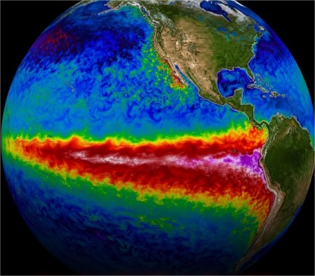
El Niño is part of a natural weather pattern linking the ocean and atmosphere known as an ENSO cycle.
It occurs when surface water in the central and eastern tropical Pacific Ocean becomes warmer than usual.
The opposite effect is known as La Niña, which is still weakly present in the Pacific ocean.
That has led to a temporary lowering of global temperatures, meaning 2025 was cooler than 2024.
Even relatively small changes in ocean temperature can have a major impact on precipitation, drought, heat and climate disasters.
During El Niño, weakened winds allow warm water to spread eastwards, altering rainfall, storm patterns and temperatures worldwide.
A ‘super El Niño’ is simply a stronger version of the same phenomenon, usually defined by temperatures rising at least 2C above average.
These events are rare but far more disruptive than a normal El Niño, which typically occurs three times per decade.
Click here to read more Spain News from The Olive Press.