TWO earthquakes of magnitude 2.6 and 2.4 hit the Costa Blanca South last night and early this morning, making it the region in Spain most affected by earth tremors.
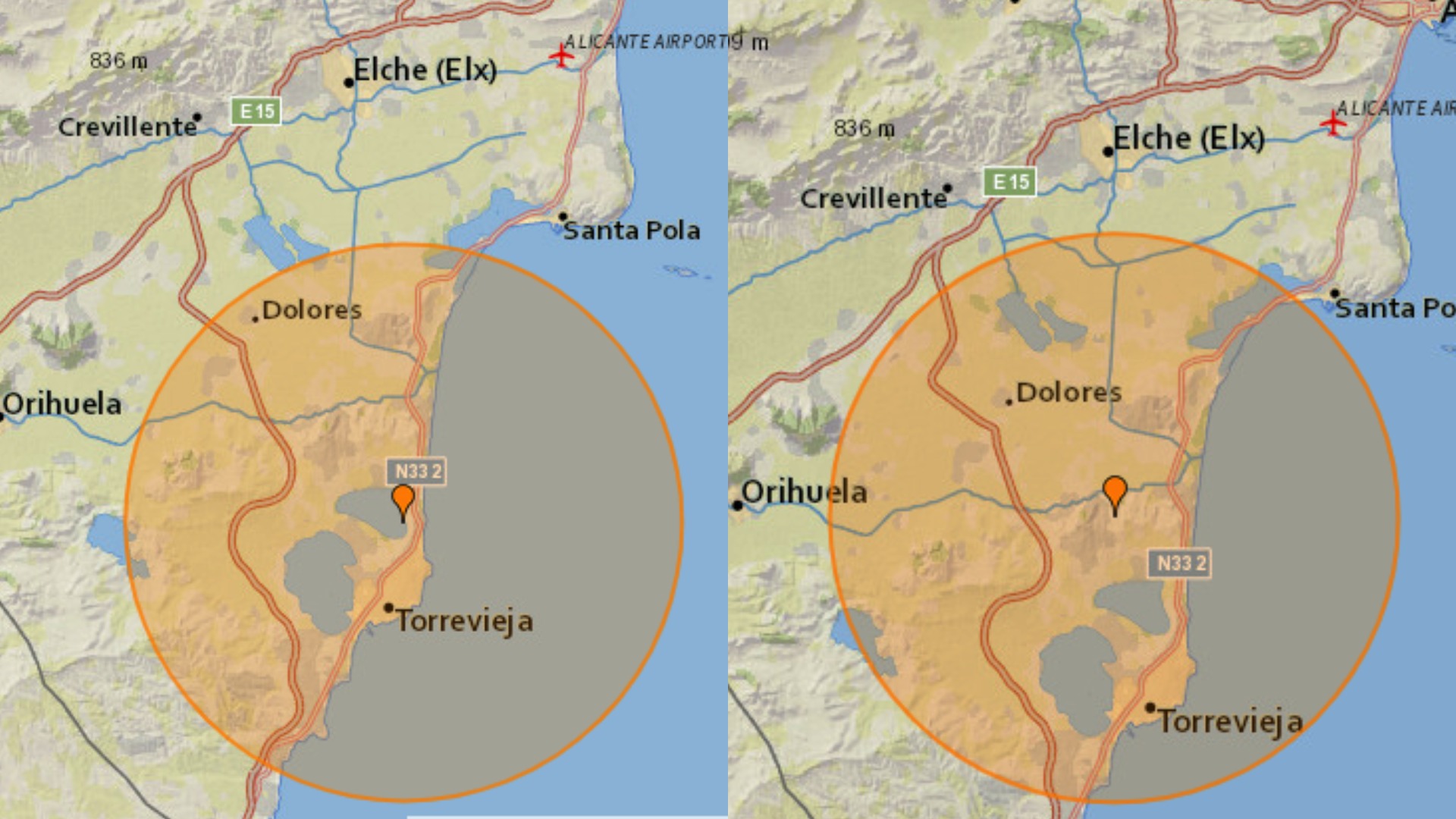
As people were enjoying the end of their All Saints Day and preparing for the week ahead, the first quake hit at 8.55pm, just north of Torrevieja.
According to the National Geographic Institute, it measured 2.6 in magnitude, the highest in the region since a 2.9 ‘quake hit Jacarilla on June 27, 2020.
An aftershock hit Rojales only hours later at 4.07am, measuring 2.4 in magnitude.
The two shocks show a worrying trend with Costa Blanca South being the epicentre of Spanish earthquakes, this year.
This map, sourced from the NGI, shows the region being hit by FIVE earthquakes of a magnitude exceeding 2.0 in 2020, alone.

Cortes de la Frontera in Andalucia was hit on October 16 and two ‘quakes hit the Navarra region on October 1, close to the French border in the north.
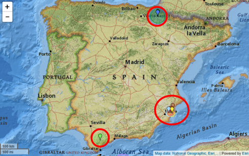
But the two rumbles last night, along with the other 2020 ‘quakes in Jacarilla, Santa Pola and Algorfa, will raise concerns.
The biggest earthquake to hit Spain was in March 1954, where a 7.8 tremor hit Durcal in Andalusia.
More recently, a quake of 6.3 magnitude hit Niguelas, also Andalusia, on April 11, 2010.
Click here to read more Spain News from The Olive Press.